|
Historic Oceanic Ni±o
Index (ONI) & El Ni±o Winter - Spring Impacts on United States Weather Patterns Jan Null, CCM |
 |
|
Historic Oceanic Ni±o
Index (ONI) & El Ni±o Winter - Spring Impacts on United States Weather Patterns Jan Null, CCM |
|
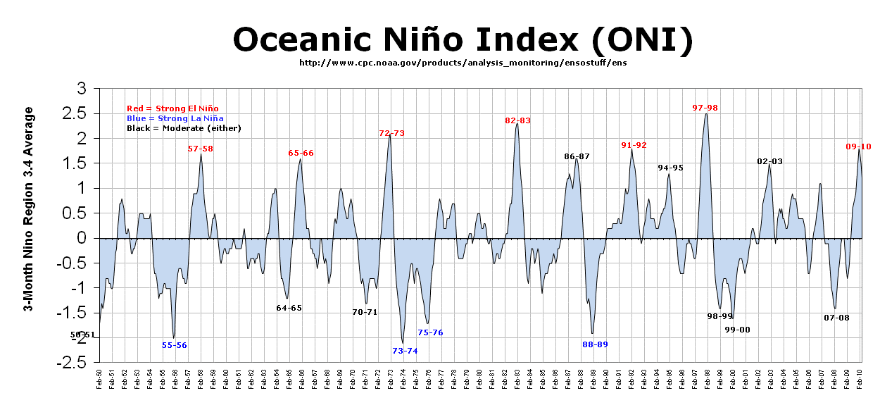
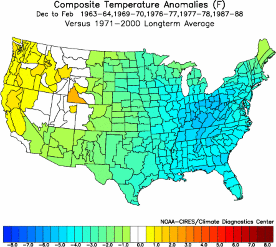
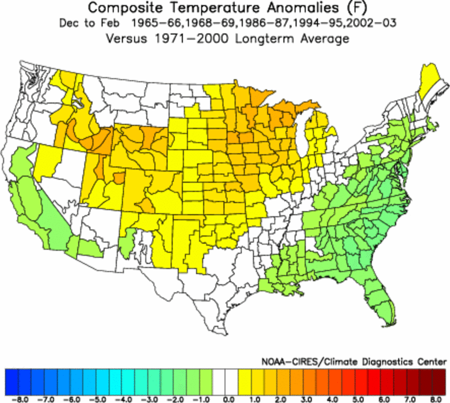
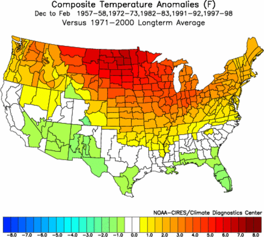
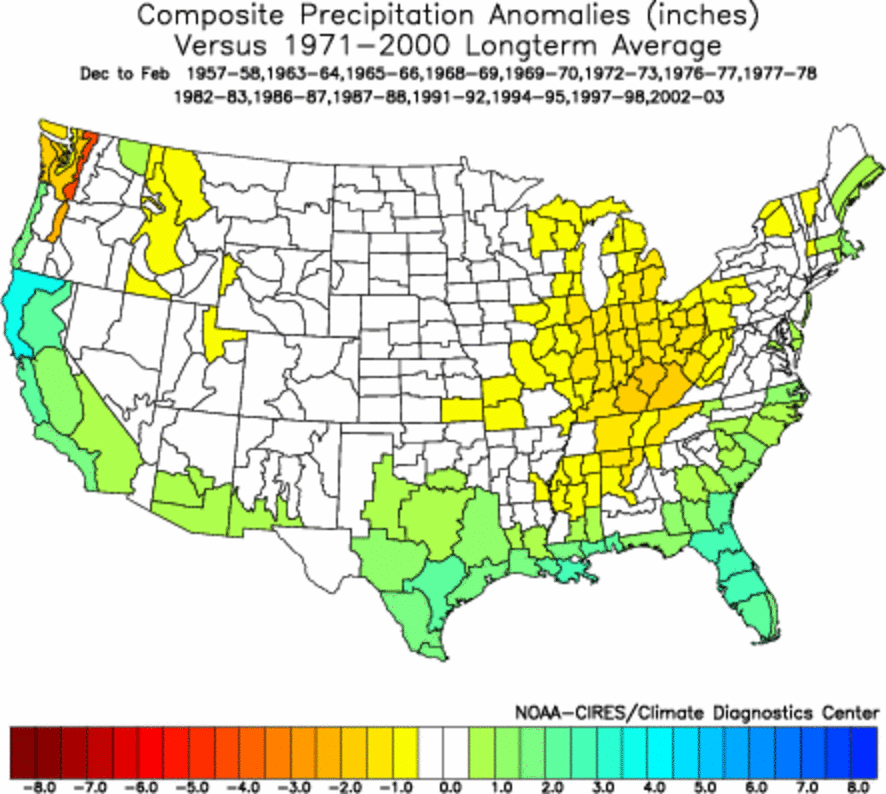
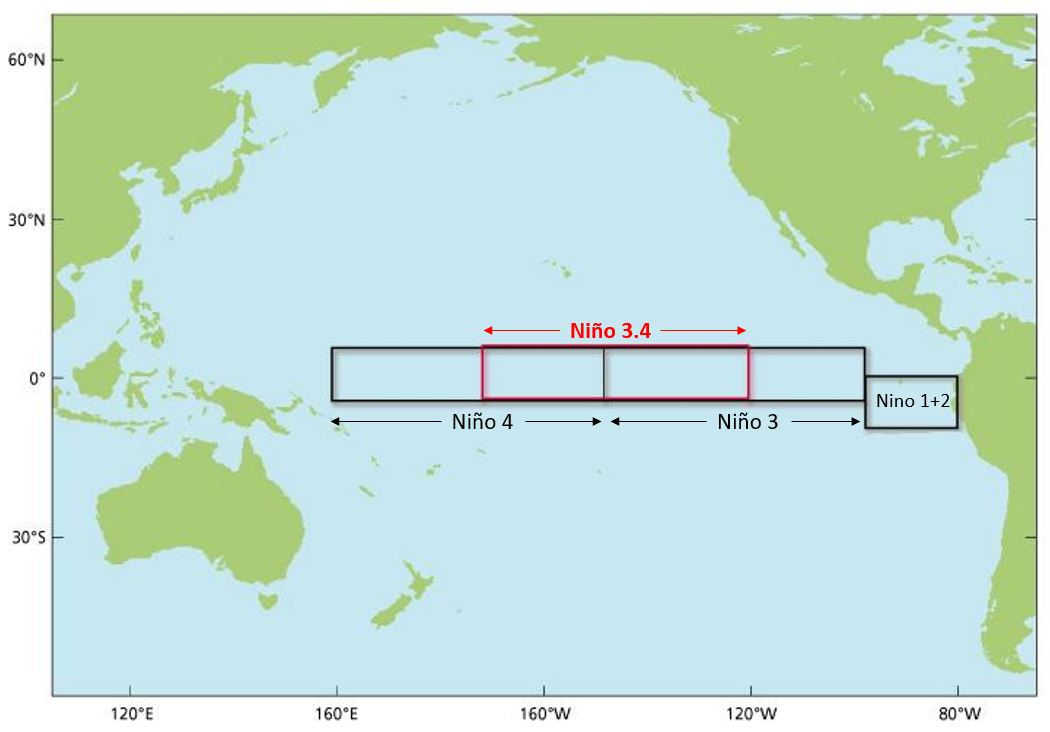
The Oceanic Ni±o Index (ONI)
has become the de-facto standard that NOAA uses for identifying El Ni±o
(warm) and La Ni±a (cool) events in the tropical Pacific. It is
the
running 3-month mean SST anomaly for the Nino 3.4 region (i.e.,
5oN-5oS, 120o-170oW).
Warm events are defined as 5 consecutive months above the .5o
anomaly. These are further broken down into Weak (with a 0.5 to 0.9
SST anomaly), Moderate (1.0 to 1.4) and Strong (> 1.4) events.
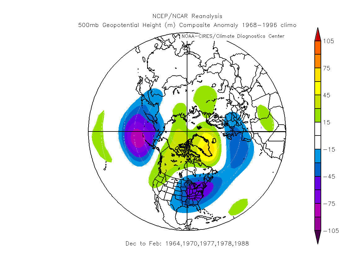
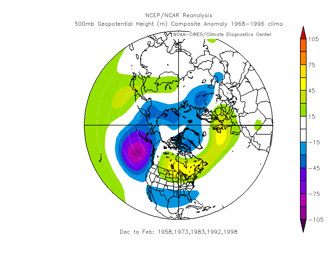
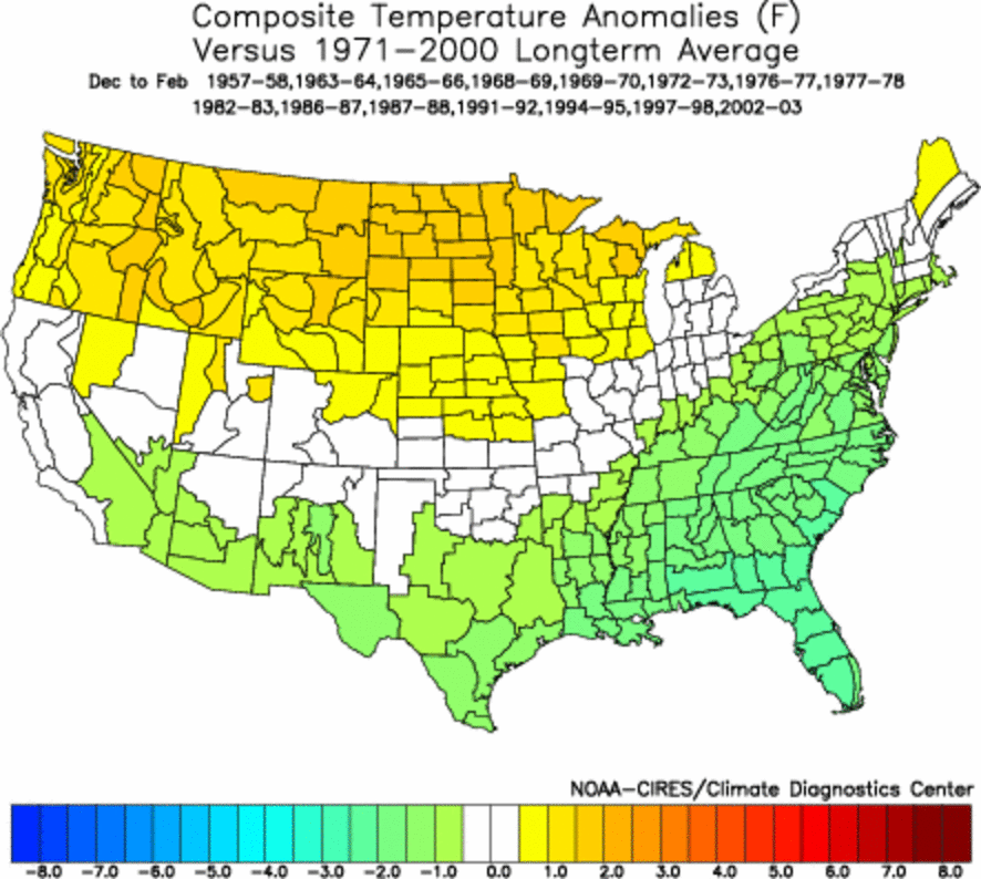
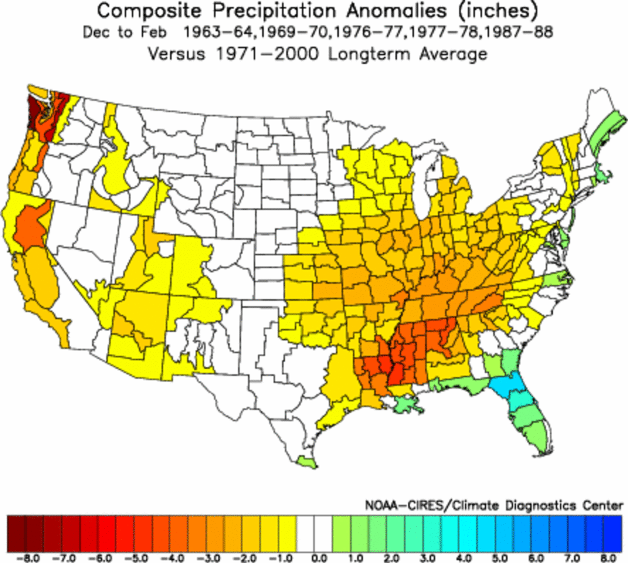
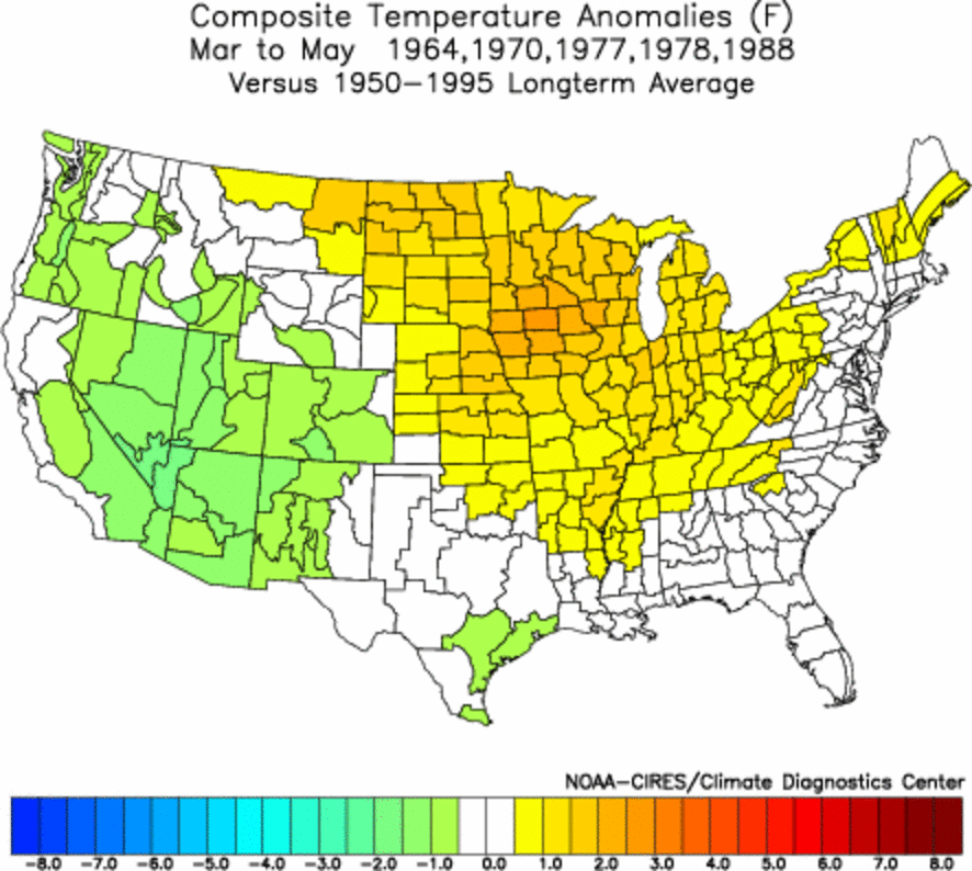
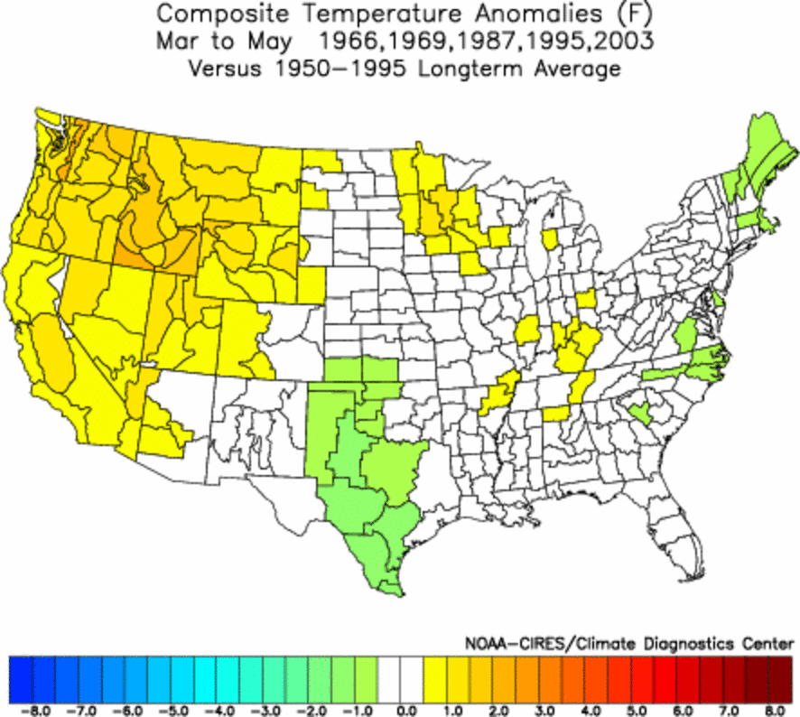
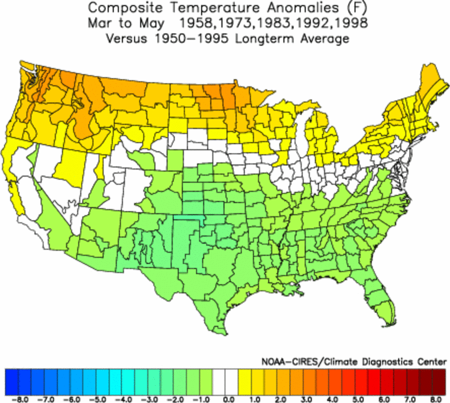
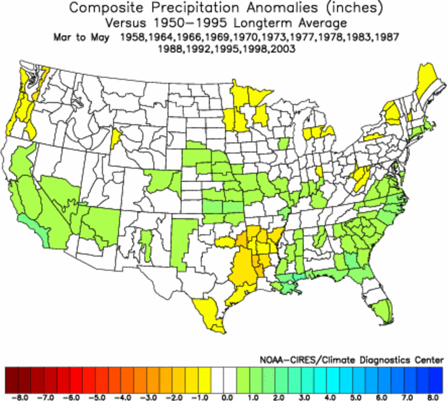
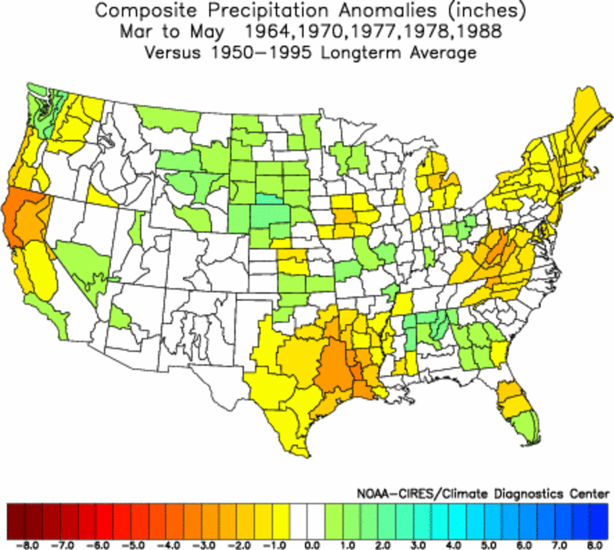
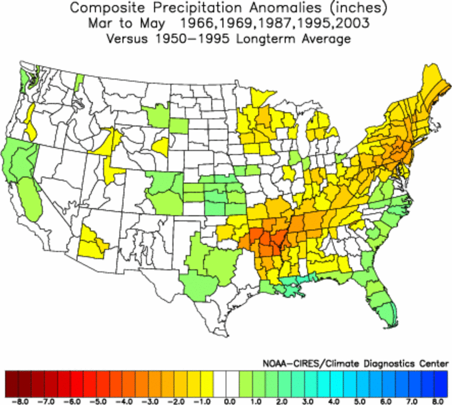
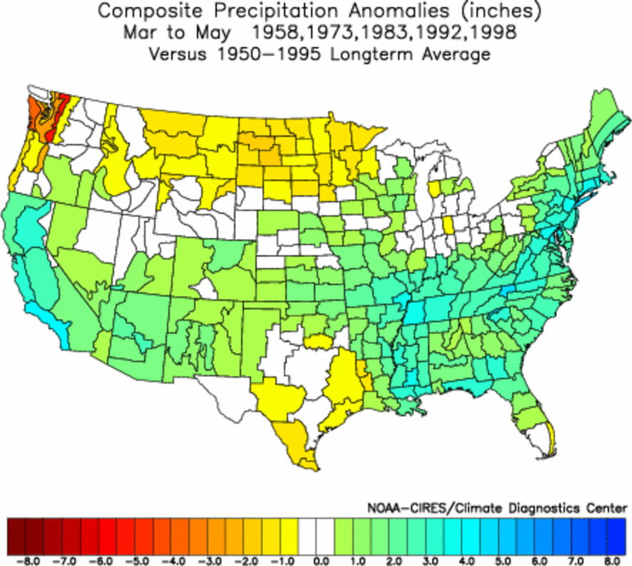
Winter Impacts (December, January, February)
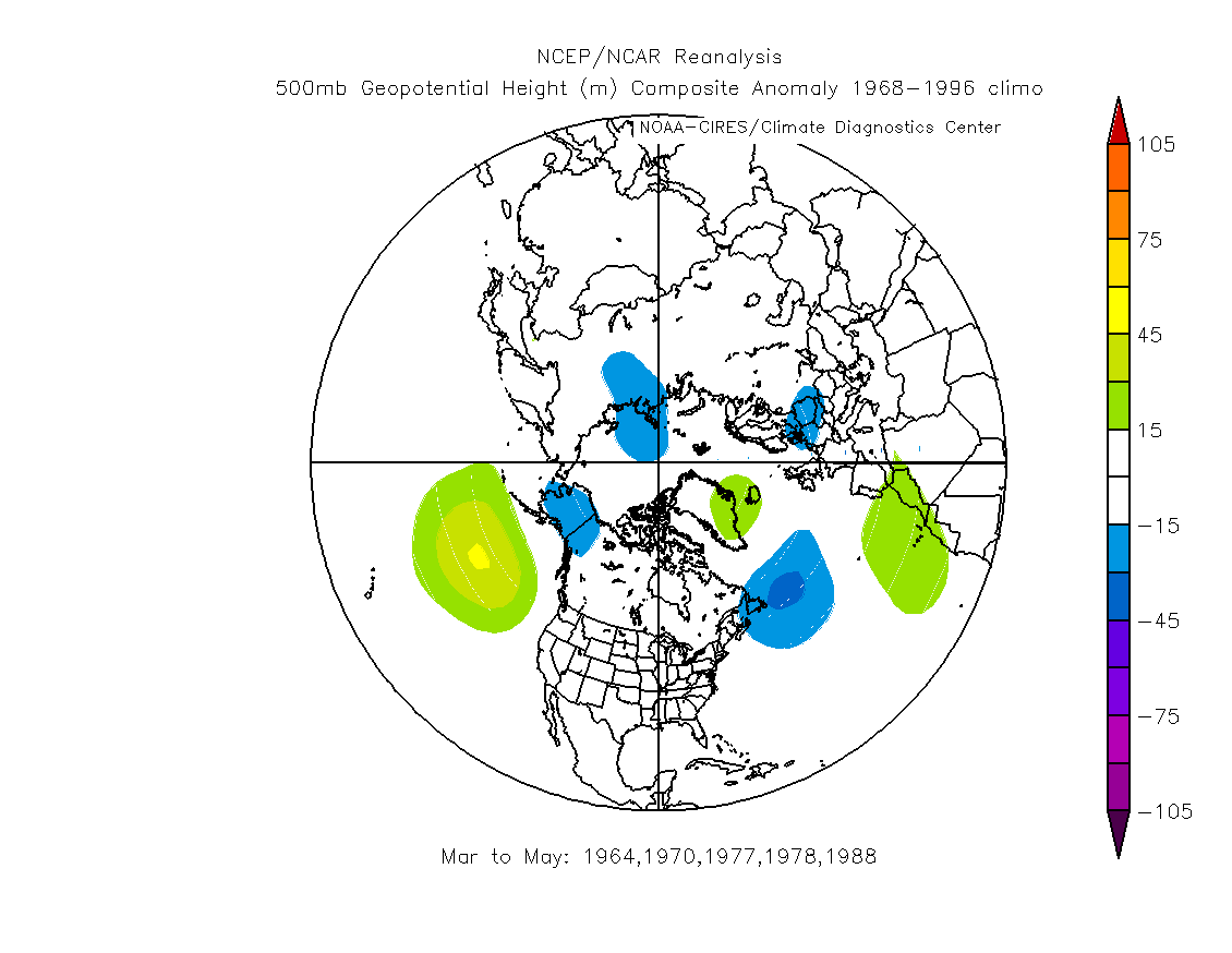
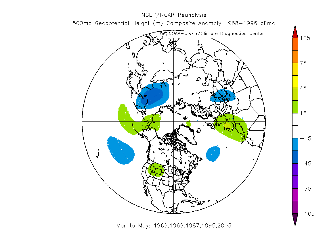
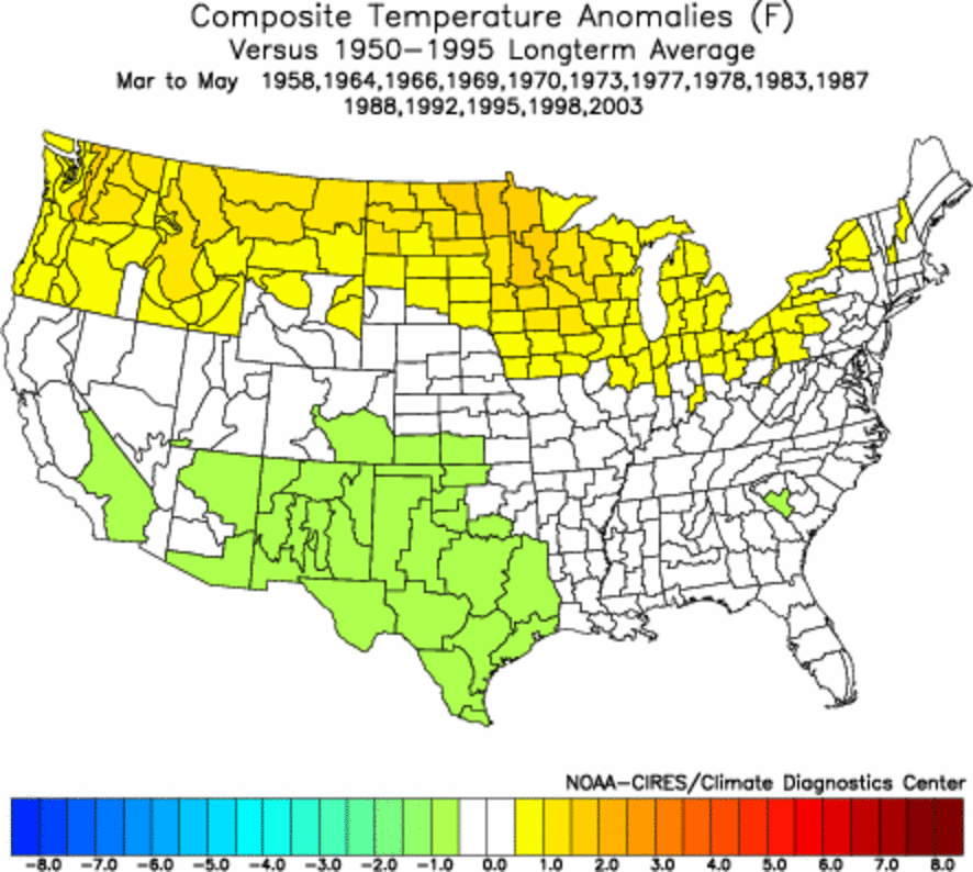
Spring Impacts (March,
April, May)
|
||||||||||||||||||||||||||||||||||||||||||||||||||||||||||||||||||||||||||||||
Copyright ® 2004,
Golden Gate Weather Services.
Reproduction in full or part is prohibited without permission.


