| NEW WIND CHILL TEMPERATURE FORMULA |
 |
| NEW WIND CHILL TEMPERATURE FORMULA |
|
On November 1, 2001
the National Weather Service will implement a "new and improved" wind
chill temperature (WCT). The original index was based on empirical data
developed in 1939 by Antarctic explorers Siple and Passel and has long
been thought by the meteorological community to have been too simplistic
and to have overstated the overall cooling effects of the wind. To
address this, the National Weather Service has developed a more modern
model that makes "use of advances in science, technology and computer
modeling to provide a more accurate, understandable and useful" WCT.
Some of the key changes in the new Wind Chill Index will include:
In 2002 a further adjustment is planned to account for the affects of solar radiation due to cloudy, partly cloudy or clear skies. For comparison Figures 1 and 2 show the differences in the indices given constant temperature (Fig. 1) and or constant wind speed (Fig. 2). (click to enlarge) Fig 1.
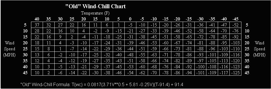
Figures 3 and 4 shows the complete "New" and "Old" Wind Chill Charts. Updated WIND CHILL RESOURCES: |
Figure 3.
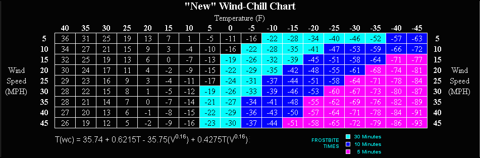
Figure 4.