|
An Analysis of El Niño, La
Niña and California Rainfall Jan Null, CCM (always a work in progress, last updated October 2004) |
 |
|
An Analysis of El Niño, La
Niña and California Rainfall Jan Null, CCM (always a work in progress, last updated October 2004) |
|
|
Introduction Early indications are that winter 2004-2005 will see a marginal El Niño develop in the tropical Pacific. But what does all this mean for rainfall across California? If all the hype of previous El Niño and La Niña events is to be believed then it's time to start looking for high ground. Or maybe just to look at what really has happened during past events.
Background The "cool" event counterpart of El Niño is La Niña. These events also disrupt the normal weather patterns in other parts of the world, though their impact is generally not as significant as El Niño in the United States. Even within these occurrences there is considerable variation and not only the intensity but even the beginning and ending dates may vary from researcher to researcher. For the purposes of this analysis the list developed at http://ggweather.com/enso/years.htm will be used as delineated in Table 1. Since these events impact winter precipitation in the Northern Hemisphere the indicated season is for the beginning of the event (i.e., 1950 would indicate the winter of 1950-1951).
Data
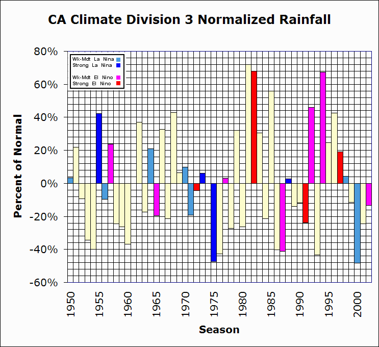
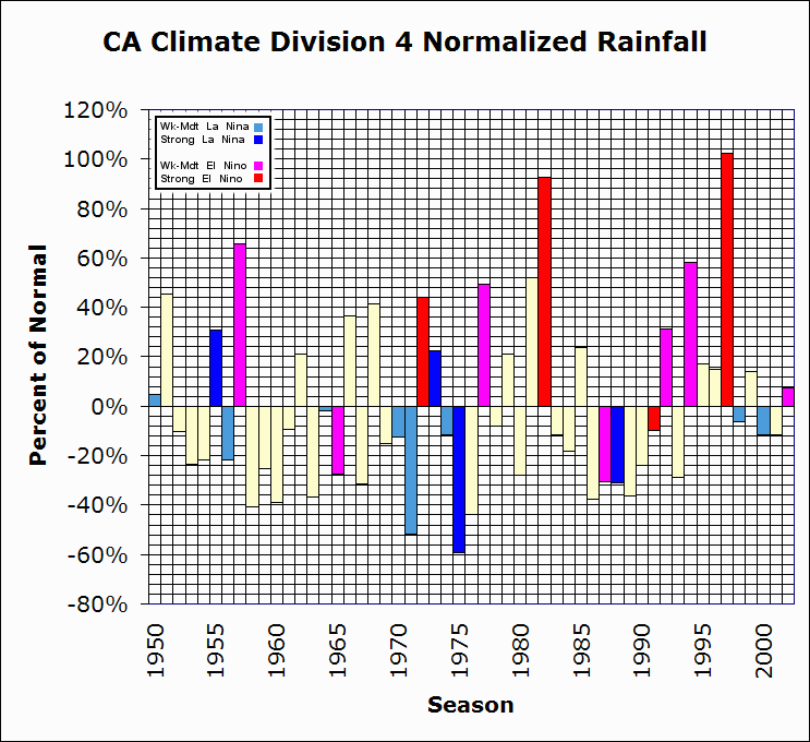
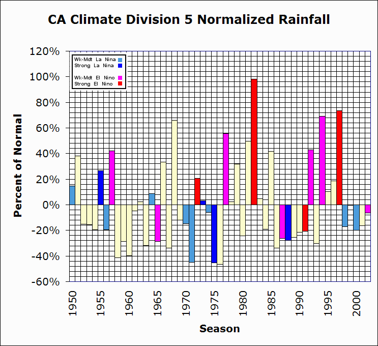
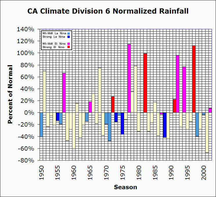
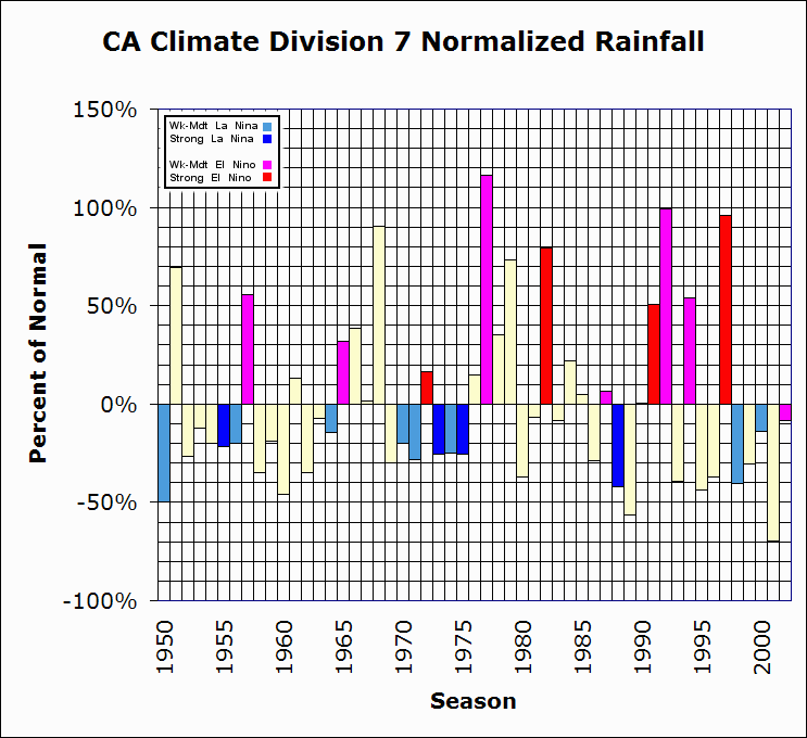
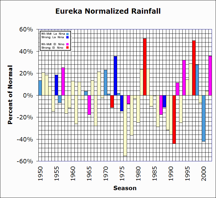
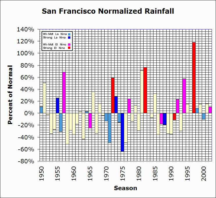
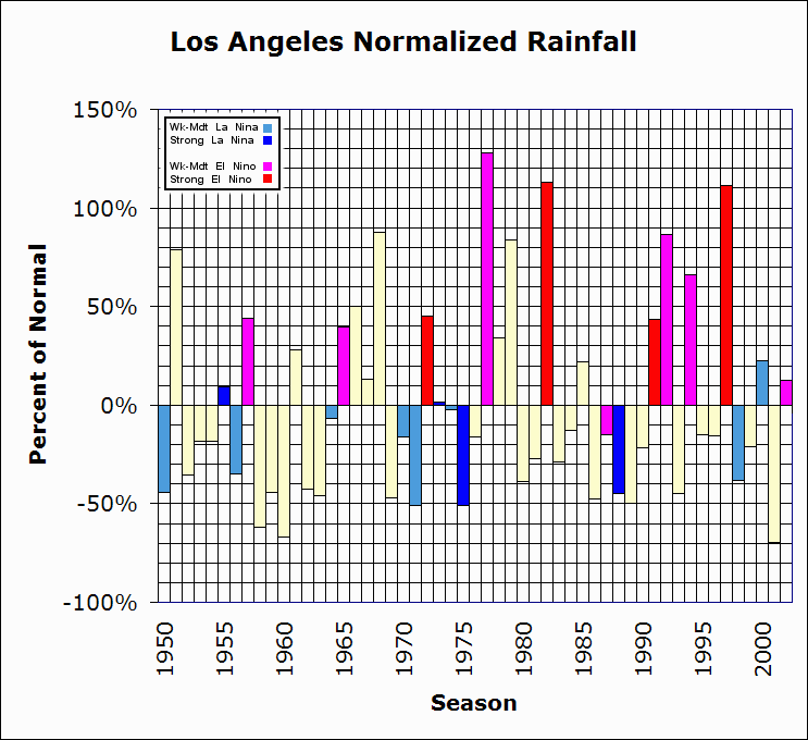
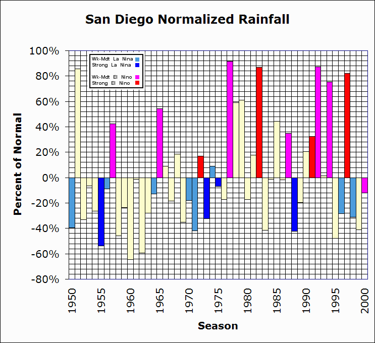
Seasonal rainfall totals were also calculated for each of the 7 California climate divisions, t, the California Department of Water Resources Northern Sierra 8 Station Index (an average of precipitation totals for Mt. Shasta City, Shasta Dam, Brush Creek, Mineral Ranger Station, Quincy, Sierraville Ranger Station, Blue Canyon and Pacific House), and for 6 key city locations (Eureka, San Francisco, Sacramento, Fresno, Los Angeles and San Diego. These were then normalized and plotted as a percentage of the average rainfall for the period and color-coded by the type of event (Figs 8-21).
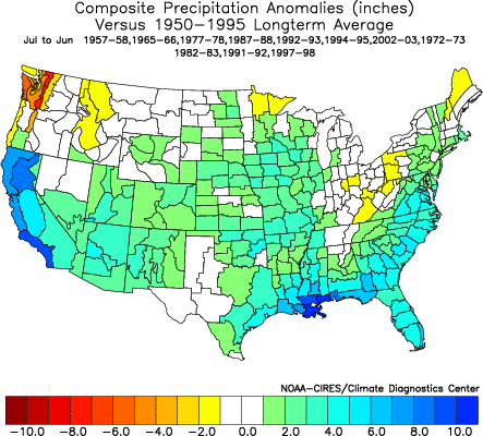
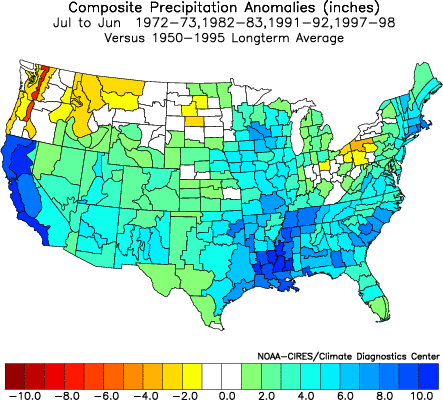
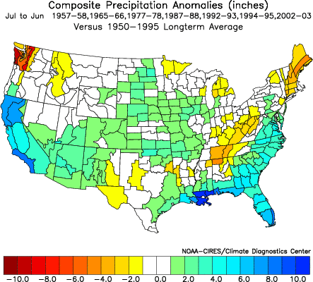
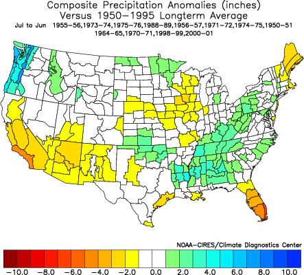
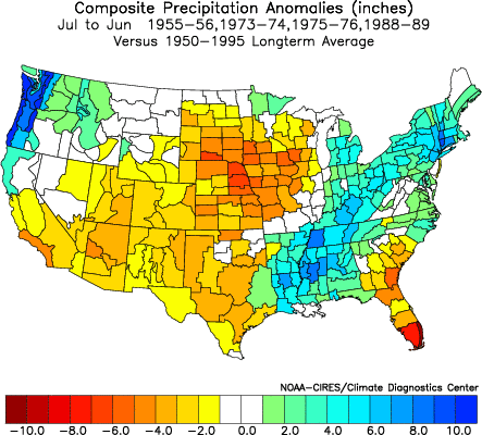
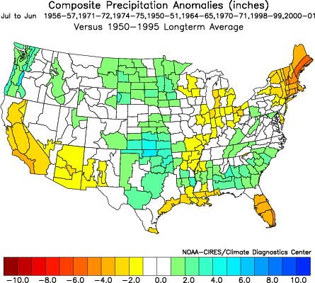
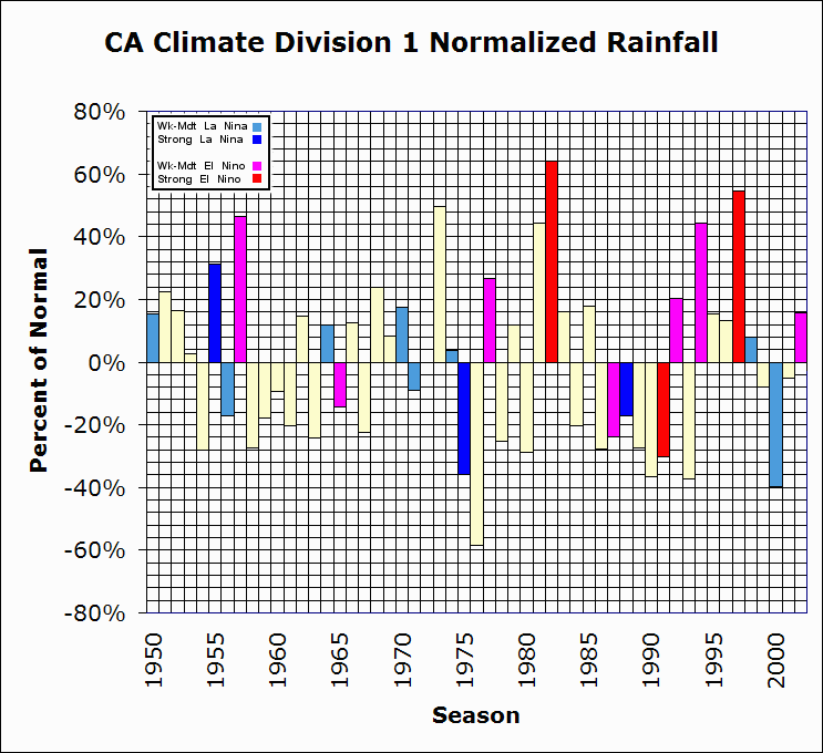
Analysis For the four strong El Niños (Fig 2) the positive signal is even stronger with no significant signal for weak to moderate events (Fig 3). Interestingly, the weak to moderate La Niñas show a more significant signal than the stronger events. In these cases all but Northwest and Northeast California (i.e., climate divisions 1 and 3) show a negative anomaly, yet in the strong La Niña cases the Northwest (Climate Division 1) is wet, Southern California (Divisions 6 and 7) are dry and Climate Divisions 2,3, 4 & 5 are neutral. In addition to looking at the response of rainfall to various El Niño and La Niña events for the individual climate divisions and cities (Fig. 8-14 and Fig. 16-21) a key indicator is the 8 Station Index which reflects rainfall into the important watersheds of the Northern Sierra Nevada and Shasta Ranges (Fig. 15). The signal for weak to moderate El Niños is mixed with 4 of the 9 events being above normal and rest below and the weak La Niñas were equally mixed with 4 cases above normal and 4 below.
Conclusion |
||||||||||||||||||||||||||||||||||||||||||||||||||||||||
| For Additional El Niño and La Niña resources see: http://ggweather.com/enso.htm |
Search
this Site
Questions, comments or suggestions. Email jan@ggweather.com
Copyright © 2003, Golden
Gate Weather Services.
Reproduction in full or part is prohibited without permission.